Details for: Ötschergipfel
Brief description
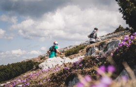
This high alpine route is a challenging ascent of the Ötscher mountain. It is part of a round tour starting in Lackenhof, and is a marked route without safety equipment (the climbing sections have been given a rating of Difficulty Level I according to the Alpine Scale). Only for experienced, sure-footed mountaineers, who are not afraid of heights and are skilled climbers. Safe and dry weather conditions are required. Old snow in the early summer is particularly dangerous!
Description
If you have never been up to the Ötscher summit, you have never seen Lower Austria!
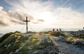
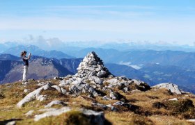
If you want to go at a more leisurely pace, you can take the chairlift from Lackenhof, look through the telescope on the Hüttenkogel and reach the 1,893 metre high summit via the broad west peak. Then the Mostviertel will be at your feet.
Starting point of the tour
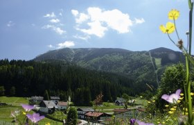
Weitental, valley station of the Ötscher double chairlift
Destination point of the tour
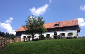
Ötscherschutzhaus – from here, you can travel back to the lower station in comfort on the chairlift.
Route description Ötschergipfel
Rauher Kamm route: From the car park in Weitental to Ötscherwiese, and on to the Raneck Saddle Pass (approx. 1 hour). At the Bärenlacken Saddle Pass (approx. 1 hour), a narrow path heading south – first flat, then steep – winds its way to the north-east ridge. Continue along the pine-lined route to the entrance of the Rauher Kamm (1533 m). Ascend to the pre-summit of the Ötscher along narrow paths and rugged rock faces. Then comes a pleasant hike over the summit plateau to the Ötscher summit. Go downhill to the Ötscherschutzhaus (approx. 1 hour), and then take the chairlift to Lackenhof, or hike downhill along the marked route via the Riffel Saddle Pass (approx. 1½ hours).
Directions
A1 exit Ybbs, Erlauftal-Bundesstrasse B 25 to Gaming and continue to Grubberg. Turn left towards Langau and Lackenhof.
Parking
Lower station of the double chairlift
mit Bahn bis Scheibbs, Buslinien des VOR bis nach Lackenhof: www.vor.at oder 0800/22 23 24
Author's tip
As a family trip with the lift to the Ötscherhaus and the Hüttenkogel (panoramic trail) with a telescope.
